Along the 25-mile drive between Enumclaw and Renton, there are 10 bridges or major culverts to cross. Three low bridges pass over the Cedar River north of Maple Valley, but the most dramatic bridge towers 155 feet above the fast-flowing waters of the Green River between Black Diamond and Enumclaw.
Originally known as the Kummer Cut-off Bridge, and sometimes called the High Bridge, it is officially named the Dan Evans—Green River Bridge. The truss bridge is 688 feet long, 28 feet wide, and steadied by a support tower on the north side to prevent sway. The finished structure was comprised of 635 tons of structural steel and 1,100 cubic yards of concrete. King County completed the structure over 16 months between June 1932 and October 1933.
The first road connecting Enumclaw, Black Diamond, Maple Valley, and Renton was constructed in 1914, but used an alternate route between Enumclaw and Black Diamond. Before completion of this Kummer connection, the road originally crossed at the Green River Gorge, near the former coal mining town of Franklin, about 2.5 miles northeast of this site. In 1937 the revised road was incorporated into the state system and designated as Primary State Highway 5. It was renumbered State Route 169 in 1964. Today it functions as a major north-south commuting route with connections to four highways: SR 18, SR 164, SR 410, and I-405, plus many county roads.
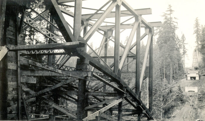
This October 19, 1932 photo by Thomas Blum was taken from the Enumclaw side of the river looking north towards Black Diamond. T.E. Blum was both a bridge inspector and an accomplished photographer who over the months of construction snapped 38 photos detailing how this massive undertaking was finished in just 16 months. These days it would probably take a government agency 16 months to simply bid the job.
The truss design was assembled section by section to provide a balanced weight on each side. Workers joined the beams together with pins and rivets using a system of stringers, braces, and struts. The truss design provides strength through geometric principles of compression with tension being forced inward. The truss segment in the foreground was extended to the midpoint, high above the river, where it joined the framework projected from the Black Diamond side. Above the bridge, thick steel cables were relayed back and forth by a hoist, akin to a giant fishing reel. The cables carried heavy loads of steel beams and connecting pieces and later in the construction process, buckets of concrete to pave the cement travel lanes.
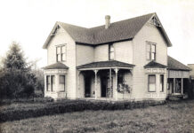
The initial bridge moniker came from the clay mining town named after George Kummer, a ceramist, and engineer working for Puget Sound Fire Clay Co., which later became the Denny-Renton Clay Co. Kummer was a company town of perhaps 75 people with a school, plus more than a dozen homes for the workers. Coal was later mined at Kummer with some of the production burned on site to fire the clay before further processing. Kummer was located about midway between this bridge and Flaming Geyser State Park, whose entrance road is located four river miles downstream.
This photo comes courtesy of the King County Archives exhibit titled, “The Bridges of King County through the Lens of T. P. Blum.”

